The Bay Area newspapers have been oddly silent lately about the Hayward Fault, and the high probability of a major earthquake very soon. Tomorrow is the 140 year anniversary of the HUGE earthquake on that fault, named after the then tiny town of Hayward, which suffered the most. At the time that earthquake was dubbed “the Great San Francisco Earthquake“ because of the devastating effect it had on the City of San Francisco, but of course that was eclipsed 38 years later by the real “Great San Francisco Earthquake”.
The significance of 140 years is that paleo-seismological studies (those combining earthquake science, radiocarbon dating, and archeology) show that the AVERAGE INTERVAL ON THE HAYWARD FAULT BETWEEN THE PAST FIVE EARTHQUAKES IS 140 YEARS!!!
No, my caps lock didn’t get stuck. I just had to make that statement stand out in an attempt to get attention. I would have thought that this fact alone would have been enough to warrant a several day series in the San Francisco Chronicle on the increasing probability of a major earthquake on the Hayward Fault, what its effect will be, and what we can do about it.
But unless tomorrow morning‘s paper comes out with a major article headlined on the front page, it would seem that the ink devoted to the danger posed by this event has fallen way behind that allocated to effect of the economic earthquake that has hit our country in the last few weeks.
For Berkeley and points north it gets worse than that. The Hayward Fault earthquake of October 21, 1868, at 7:55 in the morning, caused a massive fracture of about six feet horizontally between the Pacific and the North American Plates on the portion of the fault south of Oakland, through San Leandro, Hayward, and Fremont. That means the tension between the two plates was relieved.
However, the northern part of the fault through north Oakland, Berkeley, and the cities to the north did not move. It is still stuck to this day, and the two plates have been stuck together for at least 250 years.
In the meantime, the two plates have been moving, deep down, past each other by at least 5 to 8 millimeters a year (minimum) throughout the whole length from Fremont to San Pablo Bay, and even further north through Napa County along the Rodgers Creek Fault. If you do the math, based on 250 years of lack of movement in the northern half of the fault, that means that about 4 to 7 or more feet of slippage has to happen soon, with an attendant massive release of energy, probably equivalent to about a 7 on the Richter Scale. And that’s a very conservative estimate.
The southern part of the fault from about the middle of Berkeley, through Oakland, and south to Fremont is characterized by continual slow slippage, as is evident by the cracking and bending of buildings like Memorial Stadium, and various points of evidence in the pavement, curbs, and walkways that have been well documented. However, the evidence of slippage through North Berkeley and points north to San Pablo Bay is much more sparse.
This could mean that, in addition to the 1868 Hayward Fault Earthquake, the tension between the plates in the southern portion has been relieved by aseismic creep (continual slippage not related to an earthquake), whereas in the northern portion it has not.
Overall, the United States Geological Survey estimates the probability of a 7.0 Richter Scale magnitude earthquake on the Hayward Fault at about 30% within the next 30 years. Forgive me if I seem a bit dense, but if the last earthquake occurred 140 years ago, and the average of the last five was 140 years, and the fault slippage was only on the southern part of the fault, and there has been no slippage on the northern part of the fault for at least 250 years, and in the interim the Pacific Plate has been sliding north-west against the North American plate at the same rate of 5-8 millimeters like it always has, THEN THE PROBABILITY OF A 7.0 RICHTER SCALE EARTHQUAKE TOMORROW MORNING SOMEWHERE ON THE HAYWARD FAULT APPROACHES 100%.
Sorry for the length of that sentence, and for my caps lock getting stuck again. Or am I missing something here?
When you fly over the Hayward Fault using the Google Earth Helicopter Tour, you will be struck by how busy and detailed the data points are in some areas. Conversely, in other areas there is a dearth of information, so much so that it raises the question: is it because there is little evidence to be found in those empty areas, or is it because more study has been given to certain areas where the evidence is more easily seen?
The sources and methodology for the original map by James J. Lienkaemper from which the Google Earth Helicopter Tour was derived are described in the documentation for the Digital Database of Recently Active Traces of the Hayward Fault. The fault location was determined and further refined by i) geomorphic expression, or the study of the shape of the earth’s surface, ii) fault creep, or aseismic fault slip, and iii) the study of trenches dug near or across the fault location.
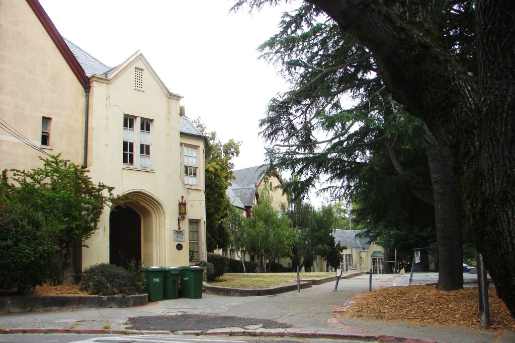
Around the University, and south into Oakland there are so many places where fault creep is evident in the roads, curbs, and sidewalks, that if you don’t watch where you are walking you will trip over them. If you want to see the evidence on a big scale, just sit in Memorial Stadium and look around you.
However, north of the University through North Berkeley and into Kensington and El Cerrito there is practically nothing. There used to be several places where the curbs were bent by fault creep around Marin Avenue and Spruce Street, but this whole area has been renovated recently with new curbs and concrete sidewalks, and the only pieces of evidence left are the symbols on the map that show where the creep evidence used to be.
There were only two trenches ever dug in Berkeley north of the University, and both were at the now-closed Hillside Elementary school. The evidence found was sufficiently alarming that the school was closed in very short order. The next trenches that were dug are about three miles to the north in the Mira Vista Golf Course in El Cerrito.
Interestingly enough, the archeological evidence discovered in these trenches shows that the northern half of the fault did not rupture in 1868 like the southern half did through Oakland, San Leandro, and Hayward. The best guess is that this part of the fault last ruptured some time between 250 and 400 years ago.
When you read the Lienkaemper documentation you will learn that the primary source for the study of geomorphic expression, or put simply, the rumpling of the earth caused by past surface rupture earthquakes, was a set of aerial photographs taken in 1939. At that time, the vegetation was less profuse than it is today, making it easier to see the evidence, but already at that time most of the evidence had been disturbed by the building of roads, schools, houses, parks, and gardens.
So we find ourselves with the situation that, through North Berkeley and beyond, not only is there very little evidence of fault creep, but few trenches have ever been dug to study the paleoseismological evidence, and the geomorphological evidence is pretty shaky due to extensive urbanization. Couple that with the fact that this part of the fault did not rupture in 1868, one can only conclude that this part of the fault is a disaster waiting to happen, any day.
Why? Because, as we said earlier, the Pacific Plate has been slowly moving in a north-west direction, deep underground, several millimeters per year, as is clearly evident at Memorial Stadium. That tension was last relieved in the southern part of the Hayward Fault by what was then called the “Great San Francisco Earthquake” of 1868, only to be supplanted by the real “Great San Francisco Earthquake” of 1906, on the San Andreas Fault.
However, on the northern part of the Hayward Fault through North Berkeley and beyond, the tension is unrelieved, either by a recent (within the last 250 years) earthquake, or by ongoing fault creep.
With a continuously moving strike-slip fault like the Hayward Fault, the longer we are away from the last earthquake, the more likely the next earthquake becomes as the years, the months, and the days go by.
I have spent the past few months studying this part of the Hayward Fault, walking its length and breadth, and documenting what I see. Recently I led a Hayward Fault Walk, which was attended by an enthusiastic crowd of about 60 people, most of whom were sufficiently interested to hang in for the whole 2 1/2 hours until the end. We only had enough time to scratch the surface of the evidence I have found.
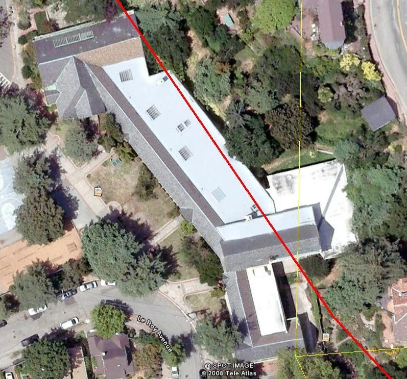
The next installment in this journal will document where probable evidence of the fault can be seen in the various paths, steps, and other man-made artifacts in North Berkeley which criss-cross the fault location at just the right angle (90 degrees).